A Nice video of Kerala backwater trip
Video of a boat trip from Kollam to Alapuzha through back waters of Kerala
Video of a boat trip from Kollam to Alapuzha through back waters of Kerala
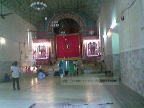
Kadamattom church is situated on the Ernakulam district in Eranakulam to Muvattupuzha route, 10 kms before Muvattupuzha , along the MC road in a calm and serene hill. There is no concrete evidence of the exact date of the establishment of the church. Believed to be built between the 4th and 10th century.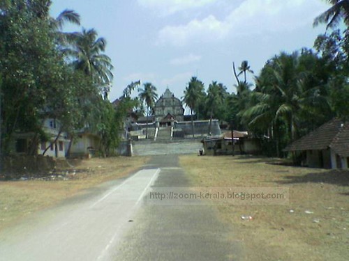
To see more of these images please visit


To see more of these images please visit
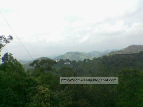
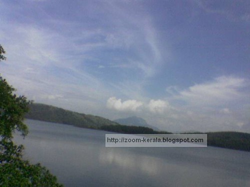
Idukki
Idukki district (Malayalam :ഇടുക്കി ) is one among the 14 districts of Kerala state, India. The district headquarters is located at Kuyilimala (earlier it was at Painavu).
Geography
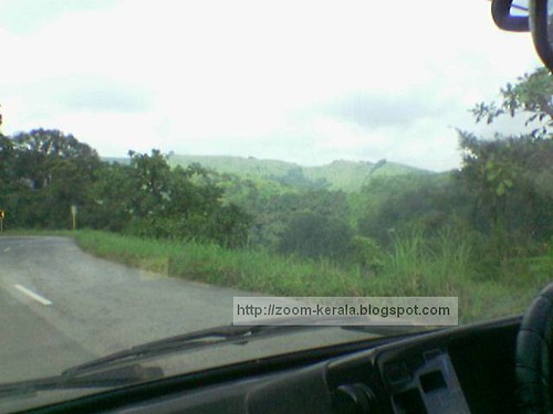
Idukki has an area of 5,105.22 km² (1,971.1 sq mi) and is the second largest District of Kerala. Rugged mountains and forests cover about 97 percent of the total area of the District. The district borders the Kerala districts of Pathanamthitta to the south, Kottayam to the southeast, Ernakulam to the northeast and Thrissur to the north and Coimbature, Dindigul and Theni Districts in Tamilnadu to the east. See:map.
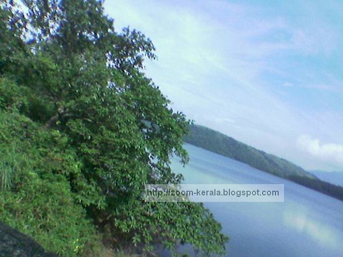
Anamudi, the highest peak in India south of Himalayas, is in the Kuttampuzha Panchayat of Adimali Block, in the K.D.H Village of Devikulam taluk. 13 other peaks in the district exceed a height of 2,000 m (6,562 ft). The Periyar, Thodupuzhayar and Thalayar are the important rivers of the district.
History
The High Range of Idukki attracted Scottish planters in the 19th century and they left behind some bungalows in an around Munnar, which are quite notable for their architectural beauty. Perhaps the most visible one to the tourists is Ladbroke House,which is named after the Ladbroke Square in London. The Trout, coniferous trees and dark green planter's cap are all contributions of those planters. Quite interestingly, Munnar had railway lines almost a century back! This started from the KDHP office at Munnar and extended up to Top Station near the Tamil Nadu border. The torrential rain and storm of 1924 destroyed the major part of the rail system and the Mattupetty dam still has the remains of the rail lines. Quite few of the rails are used as electric posts in Munnar. KDHP's tea factory has one of the wheels of the locomotives being kept there.
Idukki has the largest arch dam in India, the Idukki Dam, constructed for the Idukki Hydro Electric Power Project in 1969 with the cooperation of the Canadian Government. This single project powers almost half of the entire state and some parts of neighboring states. Mattupetty Dam is also here.
Protected areas
This district has several protected areas including: Periyar Tiger Reserve in the south, Kurinjimala Sanctuary to the east, Chinnar Wildlife Sanctuary to the north east, Eravikulam National Park and Anamudi Shola National Park to the north, Pampadum Shola National Park to the south and Thattekkad Bird Sanctuary in the west. These protected areas are especially known for several threatened and endemic species including Tiger, Nilgiri Thar, Grizzled Giant Squirrel, Nilgiri Wood-pigeon, Elephant, Gaur, Sambar Deer, and Neelakurinji.
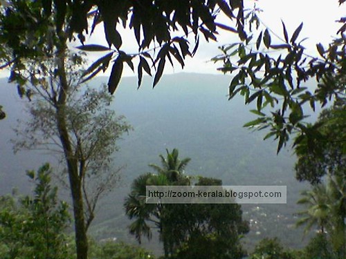
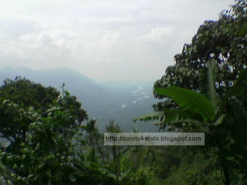
Idukki is known for the splendid green mountains, streams and spices. It is one of the a main tourist destinations in Kerala with its hill stations, Devikulam and Munnar, surrounded by lush hills, tea plantations and valleys. Mattupetty, is the headquarters of the Indo-Swiss Cattle Project, about 11 km away from Munnar.


Some of these Images were contributed by my aunties.
To see more of these images and in better quality visit following link

.JPG)
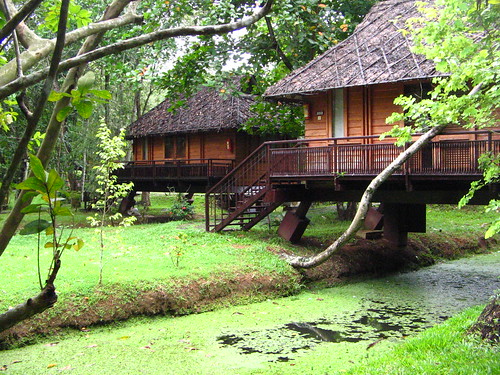
kottages in Kumarakom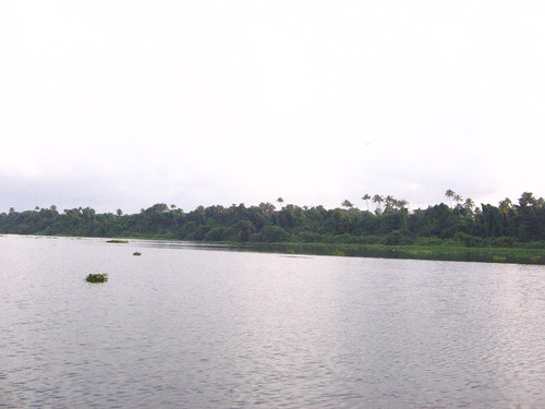
kumarakom backwaters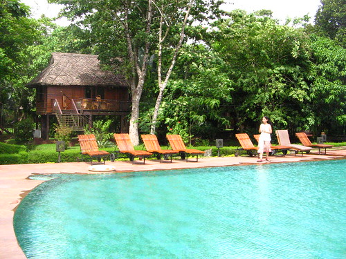
resort in kumarakom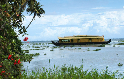
a house boat near to kumarakom
distant view of a house boat in kumarakom>
nice evening near kumarakom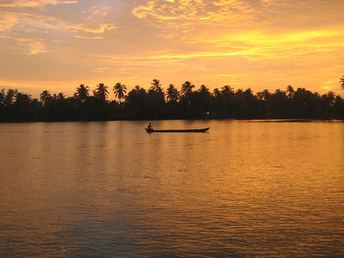
sunset in backwaters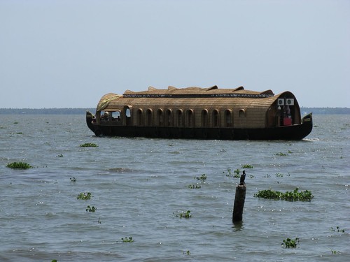
house boat in kumarakom backwaters

The village of Kumarakom is a cluster of little islands on the Vembanad Lake in Kerala, a state in India.
Environment
Kumarakom is home to a wide variety of flora and fauna. It is a noted bird sanctuary where many species of migratory birds visit. The Vembanad Lake, the largest backwater in Kerala, is habitat for many marine species and it teems with 'Karimeen' (Pearl Spotted Fish), shrimp (chemmeen in local language) and prawns. The bird sanctuary extends over 14 acres (57,000 m²), and came into existence following preservation efforts from the government. It is a major tourist attraction.
Economy
Agriculture and tourism are the major economic activities. The place has expanses of mangrove forests, paddy fields and coconut groves. This rich agricultural environment is mainly irrigated using interspersed waterways and canals. Kumarakom's perfectly balanced tropical climate is conducive to cultivation.
Modes of access
One can access Kumarakom by many means:
* By air: via Cochin International Airport and the Trivandrum International Airport
* By rail: via Kottayam (16 kilometres)
* By boat: From Muhamma (near Alappuzha) to Kumarakom Jetty.
* By road: Buses and taxis are easily available at all times of the day from Kottayam.
Tourism
There are several activities for visitors, depending on how much time, money and local language skills they have.
The Bird Sanctuary can be visited by boat, which can be arranged with local fishermen at the entrance to the sanctuary. A two-hour rowing boat trip may cost about INR 200-250, and is best undertaken in the evening or early morning to avoid the afternoon sun.
Kerala Tourism Corporation conducts nice tours to all these places. Apart from them several other tour operators are providing group tour packages covering all these places.Some resorts provides other travel facilities for small number of peoples.
Here locates some resorts which rents house boat to spend exotic night in boats.House boats or speed boats can cover longer distances but cost more for hire.
God of Small Things
Arundhati Roy's The God of Small Things is set in Ayemenem village, which adjoins Kumarakom. The explosive success of this novel has given some added touristic impetus to this area. The Taj Garden Retreat hotel complex is centered around a building that is called "History House" in the novel; it was built by British missionary Alfred George Baker, whom the locals called "Kari Saipu" (possibly an elided form of "Baker Sahib"), as in the novel. Four generations of Bakers lived in the house until 1962, speaking Malayalam, and even wearing the mundu. It is in ruins in the novel, but has been restored by the Taj group. The Ayemenem house, where Arundhati Roy spent part of her childhood (like the twins in the story), can also be visited in the village, which can be reached by boat along the Meenachal river that figures prominently in the story.
Notable persons owned to Kumarakom
* Bishop Mar Alexander Choolaparampil (1877-1951), second bishop of the Knanaya Kottayam Archdiocese
* John Abraham Illikkalam (1929 - 1988) - was a Known Agriculturist at Kumarakom, and made a study & writings about Environmental & Ecological issues of Kuttanadu Region.


kovalam lighthouse view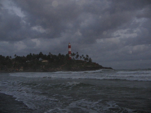
kovalam lighthouse at night
kovalam north beach view
kovalam seaside
kovalam evening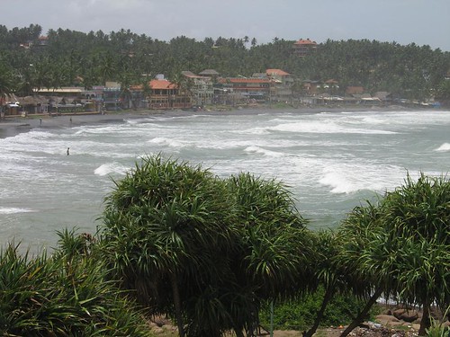
kovalam view from top of nearby hill
location of Kovalam 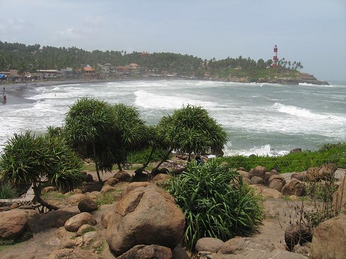
kovalam beach, a nice glimpse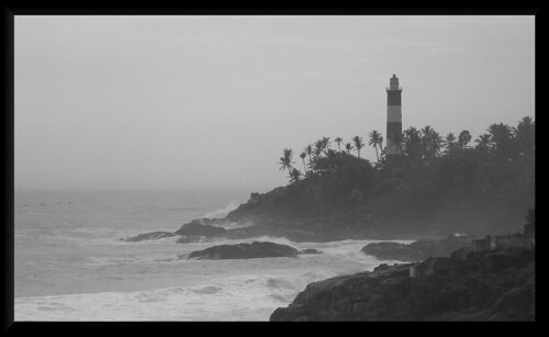
kovalam south of light house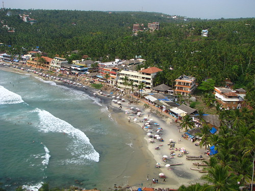
kovalam view from top of light house
kovalam another angle
Kovalam is a beach town on the Arabian Sea in Kerala, a state in south India. It is located around 16 km outside Thiruvananthapuram (Trivandrum) City in the Thiruvananthapuram district. There are a large number of beach resorts in and around Kovalam. The sea port of Vizhinjam is about 3 km away and famous for its special varieties of fish, old Hindu temples, big churches and a mosque. The Proposed International Trans shipment Terminal at Vizhinjam is also close to Kovalam.
Kovalam was among the most prominent tourist spots in India during the hippy era. It still has a high status among tourists, who arrive mostly from Europe and Israel. Kovalam is finding a new significance in the light of several Ayurvedic salons, and recuperation and regeneration resorts which provide a wide variety of Ayurvedic treatments for tourists.
There are three beaches at Kovalam, separated by outcrops jutting out to the sea. The larger one is called Light House Beach for its 30 odd metre high light house. The second largest one is Hawah Beach named thus for the topless European women who used to throng there. It was the first topless beach in India. Topfree bathing and parading is banned now except in private coves owned by resorts. Visitors frequent these two beaches. The northern part of the beach is known as Samudra Beach in tourism parlance. A large promontory separates this part from the southern side. Samudra Beach doesn't have tourists thronging there or hectic business. The local fishermen ply their trade on this part. The sands on the beaches in Kovalam are partially black in colour due to the presence of ilmenite and thorazite. The normal tourist season is from September to May.
How to reach Kovalam
* The nearest airport is Trivandrum International Airport.
* Nearest Metropolitan City is Trivandrum - 16 km
o Regular buses ply to Kovalam from the City Bus Stand at 'East Fort', Trivandrum.
* Trivandrum Central Bus Station is 14 km away.
* The nearest railhead Trivandrum Central in Thampanoor is 14 kms away and it is just opposite the Trivandrum Central Bus Station.
Calicut Region SSA click here
Other SSA click here
STD codes click here
Kerala Phone Directory
To see google Satellite map of Kalpetta click here.
Kalpetta(Malayalam:കല്പറ്റ ),is a city and a municipality in Wayanad district in the Indian state of Kerala. It is a small town surrounded by dense coffee plantations and mountains, is the headquarters of Wayanad district in the state of Ker ala in India and the only municipal town in the district. The town is a major hub to all the tourist destinations in Wayanad.
It has standard hotel accommodations. It lies on the Kozhikode-Mysore National Highway (NH 212) at an altitude of 1000 m above sea level between 14 degrees latitude and 72 degrees longitude.
Religious centres
Kalpetta was once a Jain stronghold and near the town are some of the oldest Jain temples in Kerala. The Ananthanatha Swami Temple is an ancient Jain temple located here.
Other pilgrim places near Kalpetta are listed below along with their distance from Kalpetta.
* Varambetta Mosque, a 300-year-old mosque and the oldest mosque in Wayanad district - 15 km.
* Glass Temple, dedicated to the Jain Paraswanatha swami and knowed for its mirrors reflecting the thousands of beautiful sanctum icons - 15 km.
* Pallikunnu Church, known for its annual festival in the month of January - 15 km.
* Puliyar Mala Jain Temple, devoted to the Jain saint, Anantha Natha Swami - 5 km.
Attractions near Kalpetta
There are many attractions near Kalpetta
* Edakkal Caves - 15 km
* Pookode Lake - 10 km south
* Meenmutty Falls - 25 km - 2 km jungle hike to spectacular waterfall
* Banasura Sagar Dam - 24 km - considered the largest earthen dam in India
* Soochipara Falls 20 km
* Chethalayam Falls - 37 km - smaller waterfall with opportunities for bird-watching
* Chembra Peak - 17 km - a 2100 meter peak, the highest in the area
* Brahmagiri - a 1608 meter peak
Transport
Distance in Kilometer to some major destinations from Kalpetta follows.
* Nearest airport and railway station - Kozhikode
Distance from Kalpetta in Kilometers (See the above Route map for clarity)
East direction
to Sulthan Bathery:35 km
to MYsore: 150 km
to Bangalore:287 km
North west direction
to Calicut:65 km
to Thalassery via Calicut:132 km
to Thalassery via Mananthavady:~140 km
To Kannur:155 km
to Kasargod:221 km
to Mangalore:259 km
South west Direction
to Thrissur:200 km
to Guruvayur:175 km
South East Direction
to Gudalloor:~55 km
to Ootty:~105 km
-------------------------------------------
Distance Between Calicut (Kozhikode) and
Towards North Direction
Calicut and Tellichery (Thalassery):67 km
Calicut and Kannur (Kannanore):90 km
Calicut and Kasarkod (Kasargod):156 km
Calicut and Mangalore (Mangaluru):194 km
Towards South East Direction
Calicut and Malappuram:52 km
Calicut and Palakkad: ~120 km
Calicut and Shornur: ~95 km
Towards South Direction
Calicut and Trichur (Thrissur):135 km
Calicut and Guruvayoor : 110 km
Calicut and Changanassery : 273 km
Calicut and Kottayam : 255 km
Calicut and Sabarimala : 325 km
Calicut and Munnar : 285 km
Calicut and Eranakulam ( Cochi, Cochin ):188 km
Calicut and Alleppey (Alappuzha):245 km
Calicut and Kollam:335 km
Calicut and Trivandrum(Thiruvananthapuram) : 384 km
Kalpetta(Malayalam:കല്പറ്റ ),is a city and a municipality in Wayanad district in the Indian state of Kerala. It is a small town surrounded by dense coffee plantations and mountains, is the headquarters of Wayanad district in the state of Kerala in India and the only municipal town in the district.[1] The town is a major hub to all the tourist destinations in Wayanad.
Satellite Image of Kalpetta is embedded below. You can drag the map to see neighbouring places. Also you can zoom in and zoom out by using top left controls in the map.
For more details about Kalpetta click here
Satellite Image of Kannur is embedded below. You can drag the map to see neighbouring places. Also you can zoom in and zoom out by using top left controls in the map.
For more details about Kannur click here.
Kannur, (Malayalam:കണ്ണൂര്) , is a city and a municipality in Kannur district in the Indian state of Kerala. It is the administrative headquarters of Kannur district. Kannur is the fourth largest urban agglomeration in Kerala after Kochi, Thiruvananthapuram and Kozhikode with a population of 498,175. It is popularly known as the city of Looms and Lores. Theyyam is the famous performing art of Kannur. Kannur is also famous for its beautiful virgin beaches. Another attraction of Kannur is the Handlooms.
For google satellite maps of Kannur,click here
History
Kannur was an important port on the Arabian Sea which carried out trade with Persia and Arabia in the twelfth and thirteenth centuries and it was the British military headquarters on India's west coast up to 1887. In conjunction with her elder sister Tellicherry it was the third largest city on the western coast of British India in the eighteenth century, after Bombay and Karachi.
St. Angelo's Fort
St. Angelo's Fort, built in 1505 by Sir Francisco de Almeida, the first Portuguese Viceroy of India, is on the Arabian sea about 3 km from Kannur town. The fort changed hands several times. In 1663 the Dutch captured it and sold it to Arakkal royal family. The British conquered it in 1790 and transformed it into one of their major military stations on Malabar Coast. It is fairly well preserved as a protected monument under Archaeological Survey of India. A painting of this fort and the fishing ferry behind the fort can be seen in the Rijksmuseum in Amsterdam.
Inside St.Angelo's fort
.
Demographics
As of 2001 India census,GRIndia Kannur has a population of 63,795. Males constitute 48% of the population and females 52%. Kannur has an average literacy rate of 83%, higher than the national average of 59.5%: male literacy is 84%, and female literacy is 83%. In Kannur, 12% of the population is under 6 years of age.
Tourism
The tourism of the region is highly depended upon the beaches and beach-side forts.
* Payyambalam Beach: It is the beach of the Kannur town. It has an unbroken coastline of a few kilometres. From the beach, one can see ships in transit along the Malabar coast, that is, beyond Calicut (Kozhikode) and moving towards Mangalore, Goa and Bombay (Mumbai). The well laid out garden and the massive landscaped sculpture of mother and child erected by noted sculptor Kanayi Kunhiraman makes it extremely captivating.
* Baby Beach: It is called so as it is smaller than its bigger neighbourhood, Payyambalam Beach. The famous St. Angelo Fort is adjacent to it.
* Meenkunnu Beach: Situated at Azhikode, it is hardly a few kilometres from the town. The virgin beach is a tourist’s paradise with golden sand and surf.
* Thottada Beach: Situated at Thottada just 2 km from the NH 17 connecting Kannur and Thalassery, it is hardly 7 km from Kannur town. The virgin beach is ideal for sun bathing. Tourists could stay at the beach house or guest house near the beach.
* Mappila Bay: Situated near the St. Angelo’s Fort, the Mopila bay has a historical background. Centuries ago, it was the seat of Kolathiri Kings. The Kadalayi Fort and Sree Krishna Temple were quite famous. The remnants of the fort and the temple are still seen in Mopila Bay. A fishing harbour, built with Indo Norwegian project assistance, can be seen at this bay. Boating in the sea, if the weather permits, will be an unforgettable experience.
* Dharmadam Thuruthu Situated at Dharmadam in between Kannur and Talicherry on Nationa Highway 17 is a Tourist Attraction. This is a very small island with cliff in Arabian Sea and can be travelled in a boat.
* Azhikkal Ferry: Situated near Azhikode around 10 km from Kannur town. There is the Valapattanam river joining the Arabian sea. Azhikkal ferry gives a magnificent view of the sunset. There is a granite pathway around 2 km into the sea at this place; once you reach the edge of the pathway one will be surrounded by sea from all sides.
Places near Kannur town
The well known Sree Krishna Temple at Kadalayi is situated at Chirakkal, a distance of 5 km from Kannur Town. Another well known place in Kannur is Parassinikadavu temple. The god worshipped at this temple is Muthappan. This temple is situated at a distance os around 15 km from Kannur Town.
Perallassery temple, with Subhramanian/Murugan as the main deity is 16 km from Kannur town. The temple has a deep pond, which is said to be the deepest temple pond in Kerala. This Pond is now renovated and built with Red Stone and it is a major attraction in the temple.
Madaipara: A significant plateau land lying at about 150 ft height from the sea level having sight to an extent of 20 km from all sides. It is a popular tourist location and a preferred cinema shooting site. Vadukunda Siva Temple is located on “Madai Para”.
Kannur town and Kannur City
* Kannur town - the administrative headquarters of Kannur District and a major commercial area. The kannur railway station and municipal bus stand are located in Kannur town.
* Kannur City - the old kannur 3kms away from Kannur railway station. This is the ancient capital of the Arakkal kingdom. Kannur district HQ hospital and city bus stand are located near to kannur city.
Now a days owing to fast development, the region in and around Kannur municipality is also termed as Kannur City. But this is different from the old 'Kannur city' which actually is a place name.
A friendly site under development
Get 10,000 Full Data, Fresh Opt In Leads Click here!
Please only real email addresses.
No autoresponders please!
Satellite map of Thrissur,please note that it may take some time to load.
A Brief description of Thrissur follows the map.
Thrissur
Thrissur / Trichur / Trissur) is a city situated in the center of Kerala state, India. It is the head quarters of Thrissur District. The city has a population of around 3.2 lakhs. It is an important cultural centre, and is known as the 'cultural capital of Kerala'. It is famous for the Thrissur Pooram festival, the most colourful and spectacular temple festival of Kerala. It has a large number of well-known temples, Thiruvambady temple, Vadakkumnatha temple and Paramekkavu temple, and two churches of note, the Our Lady of Lourdes Metropolitan Cathedral and the Our Lady of Dolour's "New Church" Basilica (the biggest in South Asia). The Kerala Police Academy (Second largest in India) is situated in this city.
Culture
Culture
Town Hall at Thrissur where public meetings and cultural programmes are held
Thrissur, often hailed as the cultural capital of Kerala, is built around a hillock crowned by the famous Vadakkunathan (Siva) Temple, believed to have been founded by legendary Parasurama. The temple is a classical example of Kerala style of architecture and houses several sacred shrines. It is believed that Adi Shankara spent his last days here.
Thrissur also has added to its name The Church of Our Lady of Dolours, popularly known as the New Church [or Puthen Palli in Malayalam]. It is the biggest and tallest church in South Asia[citation needed]. The Metropolitan of the Chaldean Syrian Church (the name used for the Church of the East in India) is also headquartered in Thrissur, and many religious publications are printed by Mar Narsai Press.
Elephant festival of Kerala
The major cultural attraction is the Thrissur Pooram festival, called by foreign tourists as the elephant festival is celebrated during April - May, the Elephant - Umbrella Display competition is spectacular, as richly caparisoned elephants carrying ceremonial umbrellas take the deity around the main temple. The passionate drum concerts and the spectacular firework displays are all part of Pooram celebration. Another attraction of this city is the "Puli Kali" ("Puli" = Tiger & "Kali" = Play) on the fourth day of Onam celebrations (Nalaam Onam). It is a procession of different clubs from all over the city and everyone will be in the make up of tiger. It attracts thousands to the city. Also, Thrissur is widely acclaimed as the land of elephant lovers.
Kerala Sahithya Akademy, Sangeetha Nataka Akademy and Kerala Lalithakala Academy are head quartered at Thrissur making the epithet 'cultural capital of Kerala' more meaningful.
Thrissur is also the birth place of Kerala's Indian Coffee House movement. The first ICH owned by its employees of the state opened in Thrissur in 1957.
Jos Theater, the first theater in Kerala equipped with a movie-projector, is in this city, . Malayalam, Tamil, English and Hindi movies are being released in the eight major theaters in the city.
Thrissur is also famous in the Indy-Pop Scene. Bands like Seven and Jigsawpuzzle are from this city.
For the last few years, city has been hosting the International Film Festival of Thrissur(IFFT). Around 100 films from 35 countries take part in the festival. It is the second largest film festival in Kerala after the one in Thiruvananthapuram. In 2006, there was another International Film Festival started in Thrissur, named Thrissur International Film Festival(TIFF).
Lulu International Convention Center (Second Largest in India) with helipad facilities is situated in this city.
Places of interest in Thrissur City
Shakthan Thampuran Palace Named as Vadakkekara Palace, was reconstructed in Kerala-Dutch style in 1795 by Sri. Ramavarma Thampuran of the erstwhile Princely State of Cochin, well as Sakthan Thampuran(Greatest ruler of the Cochin dynasty) is preserved by Archaeological Department.
Archeological & Art Museum It has a good collection of wood carvings, metal sculptures and ancient jewelers
Thrissur Zoo It is a major attraction for children and students with a variety of animals.
Kerala Sahitya Academy Kerala Sahitya Academy was established on August 15, 1956. It aims at the development of Malayalam Language and Literature and works in co-operation with the Kendra Sahitya Academy in New Delhi. There is a good library attached to the Academy consisting of 2 sections the General Section & the Research Section.
Kerala Lalitha Kala Academy This was established in 1962, the aim of the Academy is to promote the sculpture, painting and visual arts.
Kerala Sangeetha Nadaka Academy It is also located in city and was established on April 12, 1938. It's aim is to foster and develop Kerala Dance, Drama and Music and to promote through the cultural unity of Kerala. It works in close collaboration with the Kendra Sangeetha Nataka Academy in New Delhi for the enrichment of Indian culture. A regional theatre is constructed in Thrissur with all modern facilities.
Appan Thampuran Smarakam Established in 1976 at Ayyanthole where Sri. Ramavarma Appanthampuran who lived the Kumarapuram Palace. This is also a cultural Museum
Vilangan Kunnu This hillock has been converted by the tourism department as an amusement park. While grown ups relish the scenic splendor from the hill top. Children can relax and play to their hearts.
A brief description of Trivandrum follows this
Thiruvananthapuram/Trivandrum [t̪iruʋən̪ɨn̪t̪əpurəm] (help·info) (Malayalam:
തിരുവനന്തപുരം Tiruvanŭntapuraṁ), also known as Trivandrum, is the capital of the Indian state of Kerala and the headquarters of the Thiruvananthapuram/Trivandrum District,Kerala. It is located on the west coast of India near the extreme south of the mainland. Referred to by Mahatma Gandhi as the "Evergreen city of India", Trivandrum is characterized by its undulating terrain of low coastal hills and busy commercial alleys. With almost 745,000 inhabitants per the 2001 census, Trivandrum is the largest and most populous city in Kerala; the wider urban agglomeration having a population of about one million.
Trivandrum city is the state capital and houses many central and state government offices, organizations and companies. Apart from being the political nerve centre of Kerala, it is also a major academic hub and is home to several educational institutions including the Kerala University, and to many science and technology institutions, the most prominent being the Vikram Sarabhai Space Centre (VSSC) and Technopark.
* 1 Origin of name
* 2 History
* 3 Geography and Climate
* 4 Economy
* 5 Government and politics
* 6 Infrastructure
* 7 Transport
* 8 Demographics
* 9 Culture
* 10 Education
* 11 Media
* 12 Sports
* 13 Strategic Importance
* 14 Notes
* 15 References
* 16 External links
Origin of name Thiruvananthapuram/Trivandrum
Thiruvananthapuram/Trivandrum/Trivandrum means "City of Lord Anantha" in Sanskrit and Malayalam. The name derives from the deity of the Hindu temple at the centre of the city. Anantha is the serpent Shesha on whom Padmanabhan or Vishnu reclines. The temple of Vishnu reclining on Anantha, the Sri Padmanabhaswamy temple remains the iconic landmark of the city. The city was officially referred to as Trivandrum in English until 1991, when the government
decided to reinstate the city's original name Thiruvananthapuram/Trivandrum in
all languages. However, the city is still referred to as "Trivandrum"
informally.
History of Trivandrum/Thiruvananthapuram
Thiruvananthapuram/Trivandrum is an ancient city with trading traditions dating
back to 1000 BC. It is believed that the ships of King Solomon landed in a port
called Ophir (now Poovar) in Thiruvananthapuram/Trivandrum in 1036 BC. The city
was the trading post of spices, sandalwood and ivory. However, the ancient
political and cultural history of the city was almost entirely independent from
that of the rest of Kerala. The early rulers of the city were the Ays. With
their fall in the 10th century, the city was taken over by the rulers of Venad.
The rise of modern Thiruvananthapuram/Trivandrum/Trivandrum began with accession
of Marthanda Varma in 1729 as the founding ruler of the princely state of
Travancore (Thiruvithamkoor in the local vernacular). Thiruvananthapuram/Trivandrum
was made the capital of Travancore in 1745. The city developed into a major
intellectual and artistic centre during this period. The golden age in the
city's history was during the mid 19th century under the reign of Maharaja
Swathi Thirunal and Maharaja Ayilyam Thirunal. This era saw the establishment of
the first English school (1834), the Observatory (1837), the General Hospital
(1839), the Oriental Research Institute & Manuscripts Library and the University
College (1873). The first Lunatic Asylum in the state was also started during
the same period. Sanskrit College, Ayurveda College, Law College and a second
grade college for women were started by Moolam Thirunal (1885–1924).
The early 19th century was an age of tremendous political and social changes in
the city. The Sree Moolam Assembly, established in 1904 was the first
democratically elected legislative council in any Indian state. Despite not
being under direct control of the British Empire at any time, the city however
featured prominently in India's freedom struggle. The Indian National Congress
had a very active presence in the city. A meeting of the Indian National
Congress presided by Dr. Pattabhi Sitaramaiah was held here in 1938.
The period of Chitra Thirunal Bala Rama Varma, who took over in 1931, witnessed
many-sided progress. The promulgation of "Temple Entry Proclamation" (1936) was
an act that underlined social emancipation. This era also saw the establishment
of the University of Travancore in 1937, which later became the Kerala
University.
With the end of the British rule in 1947, Travancore chose to join the Indian
union. The first popular ministry headed by Pattom Thanu Pillai was installed in
office on 24 March 1948. In 1949, Thiruvananthapuram/Trivandrum/Trivandrum
became the capital of Thiru-Kochi, the state formed by the integration of
Travancore with its northern neighbour Kochi. The king of Travancore, Chitra
Thirunal Bala Rama Varma became the Rajpramukh of the Travancore-Cochin Union
from July 1, 1949 until October 31, 1956. When the state of Kerala was formed on
November 1, 1956, Thiruvananthapuram/Trivandrum/Trivandrum became the capital of
the new state.
With the establishment of Thumba Equatorial Rocket Launching Station (TERLS) in
1962, Thiruvananthapuram/Trivandrum/Trivandrum became the cradle of India's
ambitious space programme. The first Indian space rocket was developed and
launched from the Vikram Sarabhai Space Centre (VSSC) located in the outskirts
of the city in 1963. Several establishments of the Indian Space Research
Organization (ISRO) were later established in Thiruvananthapuram/Trivandrum/Trivandrum.
A major milestone in the city's recent history was the establishment of
Technopark—India's first IT park—in 1995. Technopark has developed into the
largest IT Park in India and third largest in Asia and is home to IT giants like
Infosys and TCS, employing around 12,500 people in close to 110 companies. This
placed Thiruvananthapuram/Trivandrum/Trivandrum on the IT map of India and it is
today one of the most promising in the country in terms of competitiveness and
capability.
Geography and Climate Thiruvananthapuram/Trivandrum
Thiruvananthapuram/Trivandrum is built on hills by the sea shore and is located
at 8.5° N 76.9° E on the west coast, near the southern tip of mainland India.
The city and the suburbs covers an area of about 250 square kilometers,
sandwiched between the Western Ghats and the Arabian Sea. The average elevation
is 16 ft from the sea level.
The area can be divided into two geographical regions, the midlands and the
lowlands. The midland region comprises low hills and valleys adjoining the Ghats.
The lowland is a narrow stretch comprising shorelines, rivers and deltas, dotted
with coconut palms. Vellayani lake, biggest fresh water lake in the district is
in the suburbs of the city. The major rivers that flow through the city are the
Karamana river, and the Killi river.
There are highlands, which form the eastern suburbs of the city. The highest
point in the district is the Agasthyarkoodam which rises 1890 m above sea level.
Ponmudi and Mukkunimala are hill-resorts near the city.
Climate of Thiruvananthapuram/Trivandrum
The city has a tropical climate and therefore does not experience distinct
seasons. The mean maximum temperature 34 °C and the mean minimum temperature is
21 °C. The humidity is high and rises to about 90% during the monsoon season.
Thiruvananthapuram/Trivandrum/Trivandrum is the first city along the path of the
south-west monsoons and gets its first showers in early June. The city gets
heavy rainfall of around 1700 mm per year. The city also gets rain from the
receding north-east monsoons which hit the city by October. The dry season sets
in by December. December, January and February are the coldest months while
March, April and May are the hottest. The winter temperature comes down to about
18 °C and summer temperatures can sometimes go as high as 35 °C.
Climate Table Jan Feb Mar Apr May Jun Jul Aug Sep Oct Nov Dec
Mean daily maximum temperature (°C) 31 31 32 32 31 29 28 28 29 29 29 30
Mean daily temperature (°C) 27 27 28 29 28 26 26 26 27 26 26 27
Mean daily minimum temperature (°C) 22 23 25 26 25 24 23 23 23 23 23 23
Average rainfall (cm) 2 2 4 11 20 33 20 12 13 26 17 6
Source: Weatherbase
Economy of Thiruvananthapuram/Trivandrum
The economy of Thiruvananthapuram/Trivandrum/Trivandrum city was earlier based
on the tertiary sector with about 60% of the workforce being employed as
government servants. Large scale industrial establishments are low compared to
other south Indian state capitals like Chennai and Bangalore. At present the
economy is growing with the contributions from more professionals in the fields
of IT, and Medical/Bio-Technology. The city contributes 80% of software exports
from the state. The opening of many private Television channels in the state,
made Thiruvananthapuram/Trivandrum/Trivandrum the home of several studios and
related industries. India's first and only animation park is situated here.
Since the establishment of Technopark in 1995, Thiruvananthapuram/Trivandrum/Trivandrum
has steadily grown into a competitive IT centre. The city was rated as the best
2nd tier metro with IT/ITES infrastructure, and second in terms of availability
of human talent. Technopark houses global majors like Infosys, TCS, McKinsey &
Co., Ernst & Young, Allianz Cornhill, Tata Elxsi, Toonz, US Technologies, etc.
The park has around 110 companies employing over 12,500 professionals. With the
expansion plans to be completed in 2007–08, this figure is to rise to about
30,000. With the completion of the 600,000 ft² Thejaswini, Technopark has become
the largest IT Park in India. The works in progress include 400,000 ft² TCS
Peepul Park and TCS Development Centre. Peepul Park is partly operational. Work
on the 460,000 ft² Leela IT building, IBS Campus and Tata Elxsi D&D Centre has
commenced while that on the US Tech Campus and Infosys campus is due to commence
shortly.
Tourism has also contributed heavily to the economy of Thiruvananthapuram/Trivandrum/Trivandrum.
Foreign tourists generally use Thiruvananthapuram/Trivandrum/Trivandrum as a hub
to explore the highly promoted tourism industry of the state of Kerala It is
also a major destination for chartered flights to India for Medical tourism, as
there are more than fifty recognised Ayurveda centres in and around the city.
This is primarily due to Ayurveda's immense popularity in the West. Medical
tourism is further promoted by the recuperation facilities available at the
beach resorts and hill stations nearby.
There are around 20 government owned and 60 privately owned medium and large
scale industrial units in Thiruvanathapuram. The major employers are the Kerala
State Industrial Development Corporation (KSIDC), Milma, Keltron, Travancore
Titanium and Hindustan Latex, all government owned. There are also about 30,000
small scale industrial units employing around 115,000 people. Traditional
industries include handloom and coir.
Commercial activity is quite low mainly due to the under-development of ports.
However, this is expected to change with the construction of the proposed mega
Deep Water Container Transshipment Port at Vizhinjam. Situated close to the
city, Vizhinjam is very close to international shipping routes and the East-West
shipping axis and hardly require maintenance dredging. Other major organizations
of economic interest are the Chithranjali Film Complex, Kinfra Apparel Park,
Kinfra Film and Video Park, Kerala High-tech Industries (KELTECH), Kerala
Automobiles and the English Indian Clays Ltd.
See also: Thiruvananthapuram/Trivandrum/Trivandrum Tourist spots
Government and politics Thiruvananthapuram/Trivandrum
The city is administered by the Thiruvananthapuram/Trivandrum/Trivandrum
Corporation headed by the Mayor. The city council is democratically elected and
comprises 84 members representing the different city wards. Several agencies
work under or in partnership with the Corporation including the Trivandrum
Development Authority (TRIDA) and Trivandrum Road Development Corporation.
Most of the city comes under the Thiruvananthapuram/Trivandrum Lok Sabha
constituency. Some northern wards of the city come under the Chirayinkeezhu
constituency. The city contributes to six legislative assembly seats namely
Kazhakoottam, Thiruvananthapuram/Trivandrum/Trivandrum North, Thiruvananthapuram/Trivandrum/Trivandrum
West, Thiruvananthapuram/Trivandrum/Trivandrum East, Nemom and Kovalam.
The city police is headed by a Police Commissioner an officer of IPS rank. The
city is divided three police sub-divisions headed by Assistant Commissioners.
There are also two traffic sub-divisions. A women's cell and a narcotics control
cell also operate in the city. The other units of Thiruvananthapuram/Trivandrum/Trivandrum
city police include Crime Detachment, City Special Branch, Dog Squad, Mounted
Police, District Crime Records Bureau, Foreigners Registration Office (FRO),
Tourist Police and District Armed Reserve. There are two state Armed Police
Battalions and a unit of the Central Reserve Police Force (CRPF) based in
Thiruvananthapuram/Trivandrum/Trivandrum. The CRPF has a Group Head Quarters
(GHQ) located at Pallipuram. There is also a large army cantonment in Pangode
where some regiments of the Indian Army are based.
Thiruvananthapuram/Trivandrum is the capital of Kerala and hence the state
legislative assembly and Secretariat are located here. The city is also the
headquarters of the Thiruvananthapuram/Trivandrum district. The only foreign
mission in the city is the Consulate of Maldives.
Infrastructure in Thiruvananthapuram/Trivandrum
The city is fully electrified by Kerala State Electricity Board (KSEB). The
district is divided in to three circles: Transmission circle, Thiruvananthapuram/Trivandrum
city and Kattakkada. Domestic consumers account for 43% of the total power
consumption, or 90 million units per month. Thiruvananthapuram/Trivandrum
district has one 220 kV, nine 110 kV and six 66 kV electrical substations. A 400
kV substation has just been commissioned by the Power Grid Corporation and will
ensure high-quality power supply to the city.
The water supply schemes cover 100% within the city limits. It is 84% of the
urban and 69% of the rural population, when the district is considered. Peppara
and Aruvikkara dams are the main sources of water for distribution in the
capital city. The new project plan for improving the water supply with Japan aid
covers Thiruvananthapuram/Trivandrum city and six suburban panchayats having
urban characteristics.
The sewerage system in the city was implemented at the time of the Travancore
Kingdom, and modernised in 1938. This scheme for the disposal of sullage and
sewage is an underground system. The whole system is controlled by Kerala Water
Authority now. The city area is divided in to seven blocks for the execution of
the sewerage system, two commissioned in the 1990s and two after 2000. The
sewerage is pumped to a stilling chamber at the Sewerage Treatment Plant (STP)
located at Valiyathura, and is disposed through sewage farming. Diary
Development Department maintains this sewage farm and fodder cultivation is done
here. There is no revenue generation from this scheme, and the sewerage system
in the city is a service provided to the residents.
Transport in Thiruvananthapuram
Within the city, city buses, taxis and autorickshaws provide means of
transportation. Scooters, motorcycles and regular bicycles are the favoured
means of personal transportation.
The intra-city public transport is dominated by the state-owned KSRTC (Kerala
State Road Transport Corporation). There are also private bus services, but are
limited in number. The city services of KSRTC operate from six depots namely,
the City depot, Vikas Bhavan, Peroorkada, Pappanamcode, Kaniyapuram and Vellanad.
These services were revamped in 2005 with the introduction of modern buses and
electronic ticketing mechanisms. The central city bus terminal is located at
East fort, near the Padmanabha Swamy temple. The Central and Inter State bus
station is located 1 km away at Thampanoor. Buses from it go to all major towns
and villages in the State as well as big cities in India such as Bangalore and
Chennai.
The Central railway station is also located at Thampanoor in the heart of the
city, 8 km from the airport. It is a very important terminus which handles over
50 trains daily. The city is well connected by rail to almost all major cities
in India. Thiruvananthapuram/Trivandrum is the first major city from south along
the second longest train route in the world, Kanyakumari to Jammu. A second
satellite station was opened in 2005 at Kochuveli, near the International
Airport.
Thiruvananthapuram/Trivandrum's International Airport, with direct flights from
the Middle East, Singapore, Maldives and Sri Lanka is the gateway to the
tourism-rich state of Kerala. Indian Airlines, Jet Airways, Air Deccan,
Kingfisher Airlines and Paramount Airways are the domestic airlines operating
from here. Air India, Air-India Express, Gulf Air, Oman Air, Kuwait Airways,
SilkAir, Etihad, Srilankan Airlines, Qatar Airways, Air Arabia and Emirates
Airline operate international flights. There are also two military airports one
near the civilian airport and the other at the Southern Air Command of the
Indian Air Force at Akkulam. Apart from regular scheduled flights, many
chartered flights from Europe like First Choice Airways from London Gatwick and
Monarch, operating with big jets, land here during the peak tourist season
(around December); with Kerala fast becoming a prime tourist destination in
India. Thiruvanthapuram airport's importance is also due to the fact that it is
the southernmost airport in India and also the closest (and thus cheapest
option) for neighbouring countries like Sri Lanka and Maldives.
The construction of the mega Deep Water Container Trans-shipment Port at
Vizhinjam is expected to begin in 2007. It is to be built in three phases, and
expected to be a key competitor in the ports business (especially for container
transshipments), with the international shipping lanes between Europe and the
Far East very close to the port, and also with major ports like Colombo, Kochi
and Tuticorin in close proximity.
The exponential growth of the services and IT based sectors coupled with its
prominence as the state capital and tourist centre has caused considerable
strain on the transport infrastructure of the city. To tackle this crisis,
several multi-million dollar construction projects are now underway including
the construction of several new underpasses and flyovers, scheduled to be
completed by early 2007. In the first phase, 42 km of six-lane and four-lane
dual carriage ways are being built.
Demographics
The city has a population of 744,739 according to the 2001 census ( nearly 1.1
million on Nov 2006). Within the city, the density of population is about 5,284
people per square kilometer. The district has a literacy rate of 89.36%. With
the sex ratio being 1,037 females to every 1,000 males, there are more women in
Thiruvananthapuram/Trivandrum than men. The wider urban agglomeration registered
a population of about one million in 2001.
Hindus comprise of 65% of the population, Christians are about 18% and Muslims
about 15%. The major language spoken is Malayalam. English and Hindi are also
widely understood. There is also a prominent minority of Tamil speakers and a
few Tulu and Konkani speakers.
Unemployment is a serious issue in Thiruvananthapuram/Trivandrum, as it is in
whole of Kerala. The increase in the unemployment rate was from 8.8% in 1998 to
34.3% in 2003, thus registering a 25.5% absolute and a 289.7% relative increase
in five years. Thiruvananthapuram/Trivandrum taluk ranked third in Kerala with
36.3% of its population unemployed. The in-migration of unemployed from other
districts also boost this high unemployment rate. Thiruvananthapuram/Trivandrum
has a high suicide rate in the state, which went up from 17.2 per lakh in 1995
to 38.5 per lakh in 2002. In 2004, the rate came down slightly to 36.6 per lakh.
This apparent paradox—high human development and low economic development—is
visible in the entire state of Kerala, and is often dubbed as the Kerala
phenomenon or the Kerala model of development.
Culture in Thiruvananthapuram/Trivandrum
The people of Thiruvananthapuram/Trivandrum are now sometimes referred to as "Trivandrumites"
, by some tourism sites and blogging community, though the word is not in common
use. Thiruvananthapuram/Trivandrum has a rich cultural background, with the
rulers of erstwhile Travancore taking an active interest in development of arts
and culture. Thiruvananthapuram/Trivandrum has produced several great artists,
the most famous ones being Maharaja Swathi Thirunal, Irayimman Thampi and Raja
Ravi Varma.
Maharaja Swathi Thirunal was a great composer and played a vital role in the
development of Carnatic music. A music college in his name exists today in the
city. Raja Ravi Varma was an illustrious painter with global recognition. His
contributions to Indian art are substantial. Most of his famous paintings are
preserved at the Sree Chithra Art Gallery in the city. The Padmanabha Swamy
Temple and the fort surrounding it, the Napier Museum and Zoo, the VJT hall,
Palayam Mosque and Church are among the prominent heritage buildings in the
city. The Veli lake and Shankumugham beach are home to various sculptures of
noted sculptor Kanayi Kunhiraman.
Trivandrum Public library
Trivandrum Public library
Thiruvananthapuram/Trivandrum easily disguises itself as a laid back quiet city
to the casual observer. However, beneath it, there is a hum of cultural
activity. The city comes to life during the festival season of Onam in
August/September, and during the tourist season later in the year. The state
government conducts the tourism week celebrations every year during Onam with
cultural events taking place at various centres in the city. The other major
events include the annual flower show, the Attukal Pongala, the Aaraat of
Padmanabha Swamy Temple, the Beemapally Uroos, Vettucaud Perunaal etc. The CVN
Kalari at East Fort, is world renowned centre for training in Kerala's own
martial art the Kalaripayattu. The Margi centre offers training in many of
Kerala's traditional arts including Kathakali.
The general cuisine of the people is Keralite cuisine, which is generally
characterised by an abundance of coconut and spices. Other South Indian
cuisines, as well as Chinese and North Indian cuisines are popular. Fast food
culture is also very prominent in the city.
Thiruvananthapuram/Trivandrum has numerous libraries, the prominent ones being
the State Central Library (Trivandrum Public library, Est. 1829), the University
Library, Thiruvananthapuram/Trivandrum Children's Library, Manuscripts Library
and the Centre for Development Studies Library. The British Council and Library
(Est. 1964) is located very near the Government Secretariat adjacent to the YMCA
Hostel.
Education in Thiruvananthapuram/Trivandrum
Thiruvananthapuram/Trivandrum is a major academic hub. The University of Kerala
is located here. The city also has several professional education colleges
including fifteen engineering colleges, three medical colleges, three Ayurveda
colleges, two Homeopathy colleges, six other medical related colleges, and some
law colleges. Trivandrum Medical College, the premier health institute of the
state is also one of the finest in the country. It is being upgraded to the
status of an All India Institute of Medical Sciences (AIIMS). The College of
Engineering, Trivandrum is one of the prominent engineering institutions in the
country. The Asian School of Business and IIITM-K are two of the management
study institutions in the city, both situated inside Technopark. The Indian
Institute of Space Technology, the unique and first of its kind in India, is
situated in here.
The schools in the city are classified as Aided, Unaided and Government schools.
The government schools are run directly by the state government and follow the
syllabus prescribed by the state government. The aided schools also follow the
state syllabus. In addition to this there are also four Kendriya Vidyalayas run
directly by the Central government which follow the CBSE syllabus and private
schools run by educational trusts or boards which follow CBSE and/or ICSE
syllabus and/or state syllabus. The first International school in Kerala, The
Trivandrum International School, was started in Thiruvananthapuram/Trivandrum on
August 2003. The literacy rate in Thiruvananthapuram/Trivandrum, according to
the 2001 census, is 89.36 percent; 92.68 percent among males and 86.26 percent
among females.
Science and Technology in Thiruvananthapuram/Trivandrum
Thiruvananthapuram/Trivandrum is a Research and Development hub in the fields of
space science, information technology, bio-technology, medicine and so on. It is
home to a cluster of research centres, which include Vikram Sarabhai Space
Centre (VSSC), Liquid Propulsion Systems Centre(LPSC), Thumba Equatorial Rocket
Launching Station(TERLS), Rajiv Gandhi Centre for Bio Technology, Tropical
Botanical Garden and Research Institute, ER&DC – CDAC, CSIR – Regional Research
Laboratory (RRL), Free Software Foundation (FSF), Regional Cancer Centre(RCC),
Sree Chitra Thirunal Institute of Medical Sciences and Technology (SCTIMST),
Centre for Earth Science Studies (CESS), Central Tuber Crops Research Institute
(CTCRI), Priyadarsini Planetarium, Centre for Development Studies, The Oriental
Research Institute & Manuscripts Library, Kerala Highway Research Institute,
Kerala Fisheries Research Institute, etc.
Media in Thiruvananthapuram/Trivandrum
Daily newspapers are available in English and Malayalam. The English newspapers
with editions from Thiruvananthapuram/Trivandrum are The New Indian Express and
The Hindu. The major Malayalam newspapers are Mathrubhumi, Malayala Manorama,
Kerala Kaumudi, Deshabhimani, and Madhyamam.
Most Malayalam TV channels are based in Thiruvananthapuram/Trivandrum. The
government owned Doordarshan began broadcasting from here in 1981. Asianet was
the first private Malayalam channel and began operations in 1991. The other
channels now based in Thiruvananthapuram/Trivandrum are Surya TV, Amrita TV,
Kairali TV, Kiran TV (Youth channel of Surya TV) Asianet Plus (Youth channel of
Asianet) and People (News and current affairs channel of Kairali TV). The local
cable services are provided by Asianet Satellite Communications Limited,
Trivandrum Cable Network Pvt Ltd and Siti Cable and they provide a bouquet of
local channels in addition to all the Indian channels. DTH services are
available through Doordarshan Direct Plus Tata Sky and Dish TV. All India Radio
has an AM (1161 MHz) and an FM (Ananthapuri FM; 101.9 MHz) station for the city.
The first private FM channel, "Radio DC" has commenced operations recently.
There are over 18 cinema halls which screen films in Malayalam, Tamil, English
and Hindi. There are also two film studios in the city, Chithranjali and
Merryland. The Kinfra Film and Video Park is located near Technopark and is one
of the most advanced film and animation production facilities in India. Leading
firms like Prasad Labs have their facilities here. The International Film
Festival of Kerala (IFFK) is held in November/December every year and is
acknowledged as one of the leading such events in India.
The basic telephone services are provided by BSNL, Reliance and Tata Indicom.
The cellular networks operating in the city are BSNL CellOne, Airtel, Idea
Cellular, Hutch (all GSM) and also Reliance and Tata Indicom (both CDMA). The
number of mobile phone connections has increased exponentially since the late
90s. Major broadband internet services are provided by BSNL DataOne, Asianet
Dataline and Siti Cable. Private providers like Relaince, VSNL, Airtel and
Satyam also have their presence in the city. The major dial-up internet
providers are BSNL NetOne, Kerala Online and KelNet among others.
Thiruvananthapuram/Trivandrum also holds the distinction of having been the
first 100% Digital SSA(Secondary Switching Area) in India.
Sports in Thiruvananthapuram/Trivandrum
The most popular sports are Football and Cricket. Basketball, Badminton and
Volleyball are also popular, mostly in schools. The Kerala Cricket Association (KCA)
is Head Quartered in Thiruvananthapuram/Trivandrum. The HQ complex of KCA, have
advance facilities including two practice turfs with nets, bowling machines,
gymnasium with multi-gym and equipment for aerobic training, lecture hall and
library, an astro-turf indoor coaching facility, fully furnished accommodation
for coaches and players, a physiotherapy clinic, functional office facilities
and guest rooms. KCA has decided to establish an international cricket stadium
in the city suburbs. The Chandrasekharan Nair Stadium is a prominent football
stadium and has hosted both national and international level matches. The
University Stadium has hosted two international cricket matches. This stadium is
under University of Kerala and is equipped with synthetic tracks for athletics
games. The city also holds the Central stadium which has facilities for
athletics, football, basketball, volleyball and cricket practice nets for
upcoming cricketers. The Jimmy George Sports Complex, the GV Raja Sports School
and Lakshmi Bhai National College for Physical Education (LNCPE) are the other
major sports establishments in the city. The city also has a Golf Club, one of
the oldest in India, and a Tennis Club (Trivandrum Tennis Club/TTC) both located
at Kawdiar. The city fields two football clubs SBT-Thiruvananthapuram/Trivandrum
and Titanium, in the second division of the National Football League. The city
also holds a fully equipped modern swimming pool located near the Jimmy George
Sports Complex at Vellayambalam. Many state level and national level swimming
competitions are held in this facility. It also holds coaching camps for people
interested in learning swimming.
Strategic Importance of Thiruvananthapuram/Trivandrum
Apart from being the capital of India’s most literate and socially developed
state, Thiruvananthapuram/Trivandrum is a strategically important city in
Southern India. Being the largest city in India’s deep south, it is important
for both military logistics and civil aviation in the southern part of the
country. It is the headquarters of the Southern Air Command(SAC) of the Indian
Air Force. The city is very close to the international shipping route and
East-West shipping axis. Also, it falls under the international air route. Due
to the strategic importance of the city, the Indian Air Force authorities have
planned to make an aerospace command in SAC. The plan for setting up a new
"Tri-Service Command", which will integrate all the three forces under a single
command, is also in the pipeline.
Being the Indian city with the closest air link to the small island-country of
Maldives and also Sri Lanka, the city’s medical and health infrastructure caters
to patients from both countries, especially Maldives. Exports of perishables and
medicines from Trivandrum International Airport run to full capacity on everyday
flights to Maldives and Sri Lanka because of this nearness. Thiruvananthapuram/Trivandrum
also provides a key link in movement of goods and passengers to and from
southern Tamilnadu into Kerala, the state border being just 30 km away. The city
is also important for people from around the world seeking help through Ayurveda
medicine and therapy. Ayurveda resorts are coming up at a rapid pace along the
International Beach of Kovalam and Varkala coast.
For more Info refer
* The Complete Directory for Trivandrum
* Official District website Thiruvananthapuram/Trivandrum
* Public Relations Department Page on Trivandrum/Thiruvananthapuram
* Government of Kerala Web page on Thiruvananthapuram
You can see corporation stadium also in this post.A brief description of Calicut (Kozhikode )follows this.
General
Kozhikode also known as Calicut, is the third largest city of (pop. 801,190:1991) and a municipal corporation in the southern state of Kerala in India. It is the headquarters of Kozhikode district, and was formerly the capital of an independent kingdom, and later of the erstwhile Malabar District. This city is the nearest town to Kappad where Vasco da Gama, the first European to sail directly from Europe (from Lisbon, Portugal) to India, landed in 1498.
History of Calicut
Zheng He's navigation chart from Hormuz to Calicut, in 1430
The ports of the Malabar Coast have participated in the Indian Ocean trade in spices, silk, and other goods for over two millennia. There are documented visits in as early as the 14th century, by Chinese travellers such as Zheng He[1]. Kozhikode had emerged as the centre of an independent kingdom by the 14th century, whose ruler was known as the Samoothirippadu (often anglicised as Zamorin).Thus Calicut came to be called the 'City of Zamorins'
In the year 1498 Portuguese explorer Vasco Da Gama landed in a place called 'Kappad' about 25 kms from Calicut city. His landing is considered as one of the important event in the History of India.
During the 16th century the Portuguese set up trading posts to the north in Kannur and to the south in Kochi, but the Zamorin resisted the establishment of a permanent Portuguese presence in the city, although in 1509 the kingdom was forced to accept a Portuguese trading post in Chaliyar[citation needed]. The Samoothirippadu later allied with Portuguese's rivals, the Dutch, and by the mid-17th century the Dutch had captured the Malabar Coast spice trade from the Portuguese. In 1766 Hyder Ali of Mysore captured Kozhikode and much of northern Malabar Coast, and came into conflict with the British based in Madras, which resulted in four Anglo-Mysore Wars. Kozhikode and the surrounding districts were among the territories ceded to the British by Tipu Sultan of Mysore at the conclusion of the Third Anglo-Mysore War in 1792. The newly-acquired possessions on the Malabar Coast were organized into Malabar District of Madras Presidency, and Calicut became the district capital.
After Indian Independence in 1947, Madras Presidency became Madras State. In 1956 the Indian states were reorganized along linguistic lines, and Malabar District was combined with the state of Travancore-Cochin into the new state of Kerala on November 1, 1956. Malabar District was divided into the districts of Kannur, Kozhikode, and Palakkad on January 1 1957.
Geography
Kozhikode is located at 11.25° N 75.77° E[2]. It has an average elevation of 1 metres (3 feet).
Places of interest
Mananchira
The temples and mosques of this district contain sculptures and inscriptions which are of considerable interest to the students of art. Kozhikode town itself has many temples, the most important of which are the Tali Temple, Thiruvannur Temple, Azhokodi Temple, Valayanadu Temple, Varakkal Temple, Bilathikulam Temple,Sree Kanteswara Temple, Bhairagi Madam Temple, Sree mathilakam temple,Kunniparambath Bhagavathi temple and the Lokanarkavu temple.
* Kozhikode Beach:
* Mananchira Square:
* Art gallery and Krishna Menon Museum at East Hill in Kozhikode.
* Lalitha Kala Academy: An art gallery adjacent to the Kozhikode town hall.
* Planetarium: Situated in the heart of the city near Jaffer Khan Colony.
* Thusharagiri: A very beautiful waterfall is about 55 km from Calicut Railway Station.
* Kappad Beach: Located less than 25 kms from Calicut city is another major attraction which is known as the "Landing place of Vasco Da Gama"
* Monkey Park: This is located near 'Kaaranthur'
Beypore
Beypore is a port city situated 10 km south of calicut at the mouth of chaliyar river. Beypore is famous for its ancient shipbuilding yard, which constructed 'uru' the traditional trading vessels of Arabs. Ship builders were famous for their extensive knowledge of ship building. The 2km bridge made of stone is another place to be visited. The bridge has been made by piling stones and stretches in to the sea.
Culture and cuisine
In the field of Malayalam Language and literature Kozhikode has made many significant contributions. The district is famous for folk songs or ballads known as Vadakkan Pattukal. The most popular songs among them are those which celebrate the exploits of Thacholi Othenan. One of the favourite past times of the Muslims of the district is the singing of the Mappila pattu and Oppana. The songs are composed in a composite language of Arabic and Malayalam. The famous intellectual debate for Vedic scholars to win the coveted position of Pattathanam takes place at Thali temple during the month of Thulam.
Kozhikode also has strong associations with two things—ghazals and football. The game has a huge fan following here, and the Football World Cup is followed with even greater enthusiasm than the unofficial national sport of India—cricket. Local clubs even pick favourites among competing nations, and vociferously support their teams.
The city also has a strong mercantile streak to it, At the olden times the main are of business was the 'Valiyangadi'(Big Bazar) where all the trade was happening and as the time progressed it shifted to other parts of the city. 'Valiyangadi' which is located near to the Calicut Railway Station and Beach had its own importance during the early years. Still some amount of business is carried out through there. Now the major vein of commerce being the "Mittai Theruvu", a long street crammed with shops that sell everything from sarees to cosmetics, and house hotels to sweetmeat shops. The name "Mithai Theruvu or "S M Street" comes from the famous sweet 'Kozhikode Halwa' which was often called as the Sweet Meat by European traders. The multicultural mix of Kozhikode ensures that Onam, Christmas and Id-ul-Fitr (the festivals of the Hindus, Christians and Muslims) are celebrated with equal pomp.
Kozhikode offers fare for every palate. Vegetarian fare includes the 'sadya' (the full-fledged feast with rice, sambhar, and eleven different curries and pappadum). However, the non-vegetarian food offered in the city is a unique mix of Muslim and Christian preparations. Some popular dishes include the Biriyani, Ghee Rice with meat curry, a whole host of sea-food preparations (prawns, mussels, mackerel, sea-fish) and paper thin Pathiris to provide accompaniment to spicy gravy. Another well known Kozhikode speciality are banana chips, which are made crisp and wafer thin, and the 'Kozhikode Halwa'.
Historical Importance
Kappad in Calicut, now a favourite beach resort for the locals, was the place in India where Vasco da Gama first arrived in 1498.
The name Calico is derived from the name of the city of Calicut. It is a type of cotton that is used a lot in soft furnishing. It was one of the first export commodities to the European nations. Calico was made by the traditional weavers of calicut called 'chaliyans'.
Peruvayal panchayat is the largest panchayat in Calicut district.
For a satellite map (medium size)of eranakulam Marine Drive please click here.
Ernakulam city refers to the western part of the mainland of Kochi city in Kerala, India. Ernakulam is the most urban part of Kochi and has lent its name to Ernakulam District.Ernakulam District is a district of the state of Kerala in southern India. The district headquarters are at Kakkanad. Kochi and Kerala recently came in to fame for Dubai Internet city project to be developed in Kakkanad. The district includes the city of Kochi, an important seaport. The Office of the Corporation of Cochin is located here. The famous "Ernakulathappan Shiva Temple" is located in the city centre.
One of the reasons for the prosperity of Ernakulam according to legend is that Pazhyannur Bhagavathi looks directly at Ernakulam; it is believed that her vision helps Ernakulam develop in all fields.
Statistics
* Area : 2407 km²
* Population (as per 2001 census) : 3,105,798
* Language: Malayalam, the official language of Kerala. English is widely used in business circles.
* Religion: chiefly Hindu, with significant Christian and Muslim minorities. Kochi has also a small population of Jains, Jews, and Sikhs.
* Average rainfall (yearly) : 3432 mm
* Temperature : between 23 and 32 °C
Geography
The District which has an area of 895 km² can be divided geographically into highland, midland and coastal area. The altitude of the highland is about 300 m. The borders of the district are the Arabian Sea in the west, Thrissur District in the north, Idukki District in the east, and Alappuzha and Kottayam districts in the south. The Periyar River, Kerala's second longest, flows through all the taluks except Muvattupuzha. The Muvattupuzha River and a branch of Chalakkudy River also flow through the district. The district has a moderate climate, and mostly falls within the Malabar Coast moist forests ecoregion, while the highlands are part of the South Western Ghats moist deciduous forests ecoregion. Many types of sands, soil and also rocks which are geological importance is abundant here.
History
From ancient times Arabs, Chinese, Dutch, British and Portuguese seafarers followed the sea route to Kingdom of Cochin and left their impressions in the town. The word Ernakulam was drawn from a Tamil word Erayanarkulam means abode of Lord Shiva.
Ernakulam District was formed on April 1, 1958, from the taluks of Aluva, Kunnathunadu, Kochi, Kanayannur, and Paravoor, which were formerly part of Thrissur District. Initially the district headquarters was at Ernakulam, which gave the district its name; the headquarters was later shifted to Kakkanad. When Idukki District was formed on January 26, 1977, Thodupuzha taluk was joined with Idukki and Muvattupuzha taluk separated with to form Kothamangalam taluk.
The present Ernakulam District includes Paravur, Aluva, Kochi, Kanayannoor, Muvattupuzha, Kunnathunadu, Kothamangalam taluks which come under Fort Kochi and Muvattupuzha revenue subdivision.One of the leading private bank in India the Federal Bank Limited is headquartered in Aluva of Eranakulam.Federal Bank is famous for its achievements in using IT effectively in its Banking services.And they are pioneers in many of the latest IT implementation of banking services.
Ernakulam is the second-most advanced district in Kerala after Kannur District. It is 47.56% urbanised.Traffic congestion and lack of housing was a major problem here. The housing problem may aggregate with more and more people migrating to Eranakulam with advances in Dubai Smart City project.Even though Eranakulam is a major hub of builders like mathor, sahara, skyline; still good housing remains as a dream for budjet conscious people.
Places of interest in Ernakulam district
* Bolgatty Island: has a palace built by the Dutch in 1744 which is one of the favorite honeymoon location for many Keralites which also has a golf course.
* Marine Drive, Kochi: Enjoy a scenic view of the sea and the Cochin Port Trust. Shopping can be done at the GCDA shopping center. Two spectacular bridges have also been built along the shore. Boat rides are available to enrich holidays.
* Willington Island : Formed from the sand deposited when Cochin Port was deepened, Willington Island has a naval base, a railway terminus, a port, and customs offices.
* Chinese Fishing Nets (Cheena Vala): can be seen at Fort Cochin.
* Parikshith Museum: Museum with memories of 19th century.
* Dutch Palace : Made in 1568 by the Portuguese. Later re-structured by the Dutch.
* Hill Palace Museum : at Tripunithura. Paintings, Epigraphy, furnitures of the royal family etc are displayed.
* Kodanad: Elephant training centre is located here, you can see cute baby elephants also here.
* Kerala Historical Museum : Located at Edappally, on the Aluva-Ernakulam road.
* Chendamangalam, a village that is the location of the Paliam palace, Vypeenakotta Seminary, and is also remarkable for having a Hindu Temple, Synagogue, Church, and Mosque, all within one kilometer of each other.
* Bhoothathankettu: A scenic dam site with boating facilities is situated in a vast virgin forest.Here locates some resorts which rents house boat to spend exotic night in boats.
Kerala Tourism Corporation conducts nice tours to all these places. Apart from them several other tour operators are providing group tour packages covering all these places.Some resorts provides other travel facilities for small number of peoples.
For further information please visit wikipedia/ (The online free encyclopedia).
Further zoom is not possible because of some restrictions.
Eranakulam Kakkanad satellite maps are added in this post.
Kakkanad is the administrative headquarters of the district of Ernakulam in Kerala, India. It is also a major industrial and residential area located east of the city of Cochin. Kakkanad is situated outside city limits and is governed by a special grade panchayat.
Kakkanad is home to many important Government buildings. These include the Civil Station, District panchayat office, Cochin High Power Transmitter, Inforpark, Cochin Special Economic Zone(CSEZ), Infopark and the Airman Selection Board. Prasar Bharati recently opened a marketing division at Kakkanad.
A well equipped theater (Gini Movies) is functioning near PHC Kakkanad.
Veega Land, one the largest water theme parks in the state, is close to Kakkanad. The upcoming Smart City and Fashion City are also at Kakkanad.
Perubavoor satellite maps are added in this post.You can see Perumbavoor Private stand,Kalady junction,Vegetable market,girls school etc.Please drag (click left button of mouse and while keeping clicked move mouse)maps to see more.A brief description about Perumbavoor follows this.
Perumbavoor is a city and a municipality in Ernakulam district in the Indian state of Kerala. It is the Headquarters of Kunnathunad Taluk. It is famous for wood industries and small scale industries. It is located at 10.1330N, 76.4830E and 33 metres above sealevel.
Ernakulam City lies 38 km southwest of Perumbavoor. It is situated northeast of Aluva, north of Muvattupuzha, South of Kalady (Birth place of Shri Shankaracharya) and west of Kothamangalam.
It lies between Thrissur and Kottayam on the Main Central Road(MC) which connects Thiruvananthapuram to Angamaly through the old Travancore part of Kerala.The Aluva-Munnar road passes through this town. The Perumbavoor - Puttankurishu Road (PP Road) which connects AM Road with NH 49 is another important road beginning in the town. Perumbavoor lies between the rivers of Periyar and Muvattupuzha, which are really wonderful gifts of nature.
Perumbavoor has one of the oldest Munsiff Courts. Its initial jurisdiction encompassed towns of Alwaye and Kolenchery which were separated later. It has a Chief Judicial Magistrate court and a Motor Accident Claims Tribunal. Perumbavoor is recently sanctioned with a Subordinate Judge's Court (Sub Court), which will start functioning from April 1, 2007.
Perumbavoor has lot of immigrants from other parts of the country. Most of them are works in plywood and other industries. Tamilians and Nepalies even have special colonies of there own at Perumbavoor. Every morning, at Kolenchery Junction one can witness hundreds of them assembling for expected manual labour.
It is one of the most strategically located industrially developing town in Kerala,since it is Nearer to Ernakulam and Angamaly, where two major highways meets. There are many small scale industries lying on the Aluva - Perumbavoor road. During night mostly, large number of Trucks caring wood and allied produces like plywood move from Perumbavoor to cities like Coimbatore,Calicut and Mangalore. It is also an upcoming area in package and carton making industry. Food processing espicially rice and condiment processing units are also abundant in Perumbavoor. Travancore Rayons,a public limited company is located in Vallom near perumbavoor. Though nearby towns like Muvattupuzha lacks industrial development, Perumbavoor surely will grow into a famous industrial town.
Tourist attractive places
The Perumbavoor municipal town and its adjoining areas have been identified as tourism spots with high potential. With Kochi emerging as a major hub of commercial activities, the municipality is actively pursuing tourism development at several picnic spots in Perumbavoor. Tourist attractive places lies near to Perumbavoor like Kodanad Elephant Training Centre, Panieli Poru waterfalls, Irigole Kavu etc. Kallil Jain Temple lies near to Perumbavoor. Mudikal which is 2 km away from Perumbavoor has a small water theme park.
Demographics
As of 2001 India census,GRIndia Perumbavoor had a population of 26,550. Males constitute 50% of the population and females 50%. Perumbavoor has an average literacy rate of 84%, higher than the national average of 59.5%: male literacy is 85%, and female literacy is 82%. In Perumbavoor, 11% of the population is under 6 years of age.
Perumbavoor town is surrounded by many small but populous commuter villages well connected by passenger bus services. Kuruppampady town is one of the main connection points for public transport for many villages and well known from years for it lemon grass oil industry.
Please visit Wikipedia.org (The free encyclopedia) for more information


